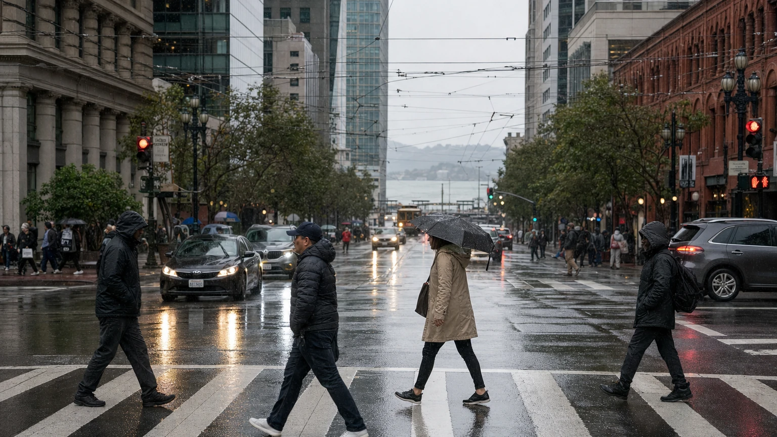
November 19: Heavy rain caused widespread street flooding
Wednesday’s storm produced confirmed flooding at 17th and Folsom, near the Panhandle and at other locations. The National Weather Service issued a new early-Thursday Flood Advisory. For reports of affected intersections, the advisory’s stated times and current checks for 311 and transit, see our November 18–19 San Francisco flooding report. These are dated incidents, not a live list of open or closed streets.
November 18 update: Coastal flooding and dangerous surf overlap the storm
The National Weather Service has issued a separate Coastal Flood Advisory through 10 a.m. Friday, November 20, PST and a High Surf Advisory from 4 p.m. Wednesday through 4 a.m. Friday, with breaking waves of roughly 18–24 feet along exposed coastline. These are tidal/coastal hazards alongside the rain and wind outlook, not a prediction of citywide inundation. Visitors should avoid exposed surf and check low-lying waterfront access before traveling.
For the latest coastal warning periods, hazards and safety advice, see the updated San Francisco high-surf report and the NWS coastal hazard statement. The earlier November 17 wind advisory has a separate forecast window and should not be assumed to remain in force after its scheduled expiration.
San Francisco and the wider Bay Area could face another round of wet, unsettled weather Wednesday, November 18, and Thursday, November 19, after a shorter period of relative calm. The National Weather Service's San Francisco Bay Area office said Sunday that the midweek system could be more impactful than the earlier fronts, but its exact path and rainfall totals were still uncertain.
November 17 update: Wind Advisory from 9 p.m. to 1 p.m.
The National Weather Service has issued a Wind Advisory for San Francisco from 9 p.m. Tuesday, November 17, until 1 p.m. Wednesday, November 18, Pacific Standard Time. The advisory calls for southwest winds of 20–30 mph and gusts up to 50 mph in the warned area, including coastal and exposed locations. Gusts will vary by neighborhood; this is not a prediction that every San Francisco street will see 50 mph winds.
Unsecured objects may blow around, tree limbs could fall, high-profile vehicles may be difficult to control, and a few power outages are possible. Secure loose outdoor items before the overnight advisory, allow extra travel time, and avoid downed power lines. The NWS alert may be updated or canceled; check the current San Francisco forecast before setting out.
For anyone planning a Wednesday commute, a trip across the Bay Area or outdoor plans later in the week, the crucial distinction is between what forecasters expect and what has actually been issued as an alert. A forecast of potentially heavier rain does not itself mean a flood warning, road closure or transit disruption has been declared.
When is the rain expected?
The NWS's November 15 afternoon discussion described three phases:
- Sunday into Monday, November 15–16: A front brings rain across the region, with post-frontal showers potentially continuing into Monday afternoon.
- Monday night into Tuesday, November 16–17: A relative lull, with cool temperatures. The NWS said colder inland valleys may require frost or cold-weather advisories, depending on later forecasts.
- Late Tuesday through Thursday, November 17–19, potentially into early Friday: Another weather system approaches. The NWS described this as potentially more impactful, partly because a slower-moving frontal band could deliver rain over a longer period in a particular location.
The most important practical question—how much rain will fall in a specific neighborhood or watershed—was not reliably settled in the available discussion. Forecasts can change materially as the system approaches. Check the latest NWS forecast rather than relying on a total quoted several days ahead.
What could be affected in San Francisco?
Roads and commuting. Heavy bursts of rain can reduce visibility, slow traffic and expose drainage problems, even without an official flood warning. Drivers should allow extra time, avoid entering standing water and consult live traffic or transit alerts before leaving. Nothing in the cited forecast establishes that a particular freeway, bridge, tunnel or Muni route will close on Wednesday or Thursday.
Muni, BART and ferries. Forecast weather can increase the risk of service disruptions, but predicted rain is not a confirmed service alert. Check SFMTA's alerts, BART service advisories and the operator of any planned ferry trip on the day of travel.
Beaches and coastal walks. The NWS was separately warning of hazardous high-surf conditions into Tuesday morning, November 17. The storm forecast is not permission to return to exposed rocks, jetties, beaches or low coastal paths; always check the latest coastal warnings. See SF News Today's existing high-surf advisory coverage for the separately timed warning/advisory history.
Outdoor events. Before visiting a park, walking the Embarcadero or making outdoor plans, confirm that an organizer has not made a weather-related change. Do not infer cancellation merely from the forecast.
Where can I check the latest storm and flooding information?
For the most current details, use the NWS San Francisco Area Forecast Discussion, local NWS forecasts and NWS alerts. For a specific address or commute, use the local forecast and current operator advisories instead of a region-wide headline.
San Francisco residents can report a localized street problem to 311 where appropriate. If conditions become dangerous, follow official emergency directions and avoid driving through floodwater.
What to watch next
The useful updates are a newer NWS discussion, a more precise forecast for the Wednesday and Thursday periods, any actually issued wind/flood/coastal advisories, and specific official transit or road restrictions. For the latest forecast timing, issued advisories and confirmed service disruptions, use the official weather and transport sources linked here. Forecast details may change before Wednesday and Thursday.