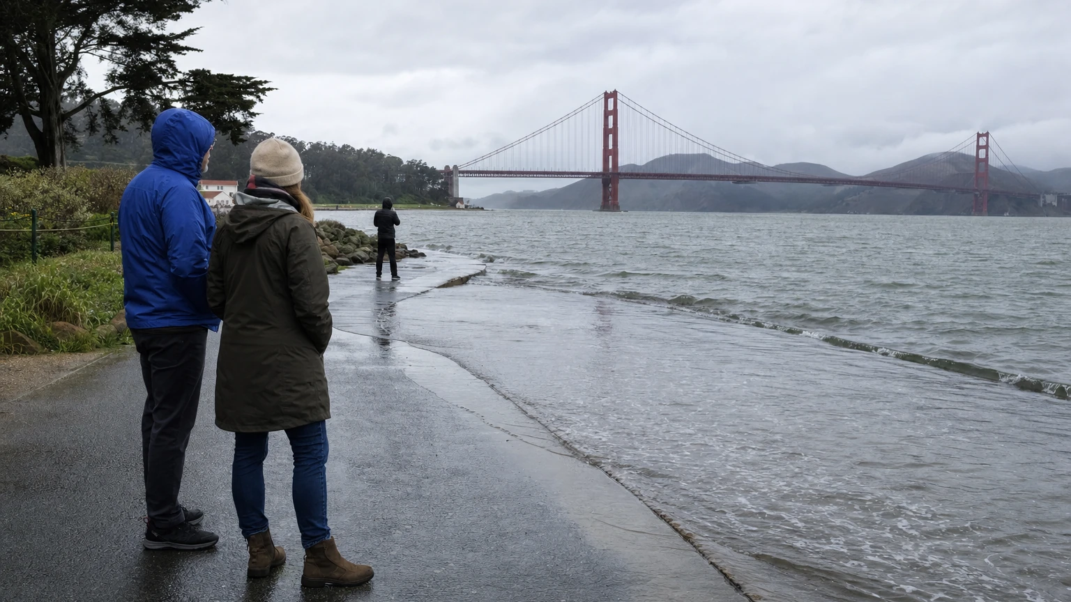
Updated Friday, November 20, 2026, after the 2:52 p.m. PST NWS bulletin: A Coastal Flood Warning has been issued for San Francisco and San Pablo Bay shorelines from 6 a.m. Monday, November 23, until 4 p.m. Thursday, November 26. The separate Coastal Flood Advisory for those bay shorelines was extended through 6 a.m. Monday, November 23. These alerts concern low-lying waterfront areas; they do not imply all of San Francisco will flood. Read the NWS San Francisco alert.
San Francisco’s November 24–26 king tides coincide with this warning. The NOAA station 9414290 astronomical prediction peaks at 7.03 feet MLLW at 10:49 a.m. Wednesday, November 25. By contrast, NWS expects the actual water level including weather-driven effects could be about 8.8 feet MLLW at that time. These are different forecasts, neither is a measurement of street-level flood depth.
Under its November 20, 2:52 p.m. PST issuance, NWS warns that up to 3.0 feet of inundation above ground level is possible at vulnerable low-elevation locations along San Francisco and San Pablo Bay shorelines during the warning period. It forecasts higher water levels across the week, including about 8.7 feet MLLW Tuesday at 10:05 a.m., 8.8 feet MLLW Wednesday at 10:49 a.m., and 8.4 feet MLLW Thursday at 11:38 a.m. These NWS meteorologically influenced water-level forecasts must not be confused with the lower astronomical NOAA tide predictions in the table below. NWS has also placed the San Francisco Peninsula Coast under a separate Coastal Flood Advisory from 4 a.m. Saturday, November 21, to 4 p.m. Thursday, November 26.
San Francisco king tide times, November 24–26 (PST)
| Date | Predicted morning high tide | Height (feet MLLW) |
|---|---|---|
| Tuesday, Nov. 24 | 10:05 a.m. | 6.94 feet |
| Wednesday, Nov. 25 | 10:49 a.m. | 7.03 feet |
| Thursday, Nov. 26 (Thanksgiving) | 11:38 a.m. | 6.95 feet |
Source and units: These are astronomical tide predictions for NOAA station 9414290, San Francisco, in Pacific Standard Time, with heights in feet above mean lower low water. They are not observations, not feet of water on a street and not a guarantee of a specific flood depth. Wind, pressure, rain, currents and waves can add to or subtract from predicted tide levels. The forecast may change.
When does the coastal flood advisory change to a warning?
For vulnerable San Francisco and San Pablo Bay shorelines: the Coastal Flood Advisory remains in effect until 6 a.m. Monday, November 23, when the issued Coastal Flood Warning begins. The warning is scheduled to continue through 4 p.m. Thursday, November 26. The Weather Service warns that unusually elevated tides can flood low-lying roads, pathways, waterfront lots and infrastructure. Avoid inundated areas and never drive around barricades. The earlier Friday morning bulletin, which gave a Saturday November 21 advisory end time, has been superseded by the 2:52 p.m. update.
A November 18–20 High Surf Advisory expired at 4 a.m. Friday, November 20, according to its stated window. That does not make beaches or waterfront rocks automatically safe: surf and local conditions must still be assessed separately. Our existing high-surf advisory history explains the changing alert periods without relabeling an expired alert as current.
Where should San Francisco residents pay attention?
Low-lying bay-facing waterfront routes, docks, parking lots, paths and intersections are more vulnerable than inland hill neighborhoods. Around the Embarcadero and San Francisco shoreline, keep clear of water overtopping seawalls or entering low spots. The NWS advisory and warning apply to vulnerable shoreline areas; they do not predict that every waterfront street will flood. The city and Caltrans have been preparing flood barriers; exact street closures require separate local verification.
A predicted 7-foot tide at a tidal gauge should never be converted into a claim of 7 feet of water on a sidewalk. If saltwater covers a pathway, turn around; do not drive into water where depth or damage is unknown. Use SF 311 to report non-emergency city drainage or street flooding concerns and call 911 for immediate danger. Follow NWS alerts and agency traffic signs rather than old social-media footage.
Has a Coastal Flood Warning already been issued for November 24–26?
Yes. NWS San Francisco issued a Coastal Flood Warning at 2:52 p.m. PST Friday, November 20, covering San Francisco and San Pablo Bay shorelines from 6 a.m. Monday, November 23, through 4 p.m. Thursday, November 26. The warning is issued in advance for a future period; it does not mean warning-level flooding is occurring at every shoreline location now. The parallel Coastal Flood Advisory is in effect through 6 a.m. Monday. Continue checking official updates because forecasts and impact locations can change.
Practical takeaway: For a waterfront trip, consult NOAA's updated tide table, check NWS active alerts, allow for changing access around the Embarcadero, and remember that Wednesday, November 25 at 10:49 a.m. PST is the highest astronomical tide of the three-day window, while the NWS warns that actual water levels may run higher.